Saturday, May 19, 2012

Camping/Reunion/Virginia counties

Over Mother's Day weekend, Steve and I packed up the bikes in the trailer and the dogs in the truck and took off for Luray, Va. This weekend had two overall purposes. One was to join up with distant relatives at a family reunion on Steve's side. The other was to complete our Virginia county collection. We had six more to go when we started out on this trip.

Luray is famous for the caverns there and its close proximity to the Shenandoah river, valley and mountains. I look forward to coming back some time just to enjoy those things specifically.

We stayed at a Jellystone Camp resort. It's the kind of place you could take the kids and never even leave the campground. There are two swimming pools, big water slides, a pond for fishing and paddle boating, and a huge playground. It's a little expensive if all you're going to do is camp, which is what we were doing. I wish I had looked for another place just for a cheaper price. We were there "off-season" and the water/electric hook up sites were $37 a night. Having said that, it was very well-maintained, clean place and perfect if you're camping with children. We weren't camping with kids, so we could have gone for a less commercialized campground.  The other good thing about it being such a family-oriented campground is that there was no late-night camping parties going on.

Belle and I sitting by the campfire.
When we camp with our dogs, we have to take into consideration the time of year. Our current trailer doesn't have an air conditioner, so we could not do this in the middle of the summer. We go on day rides on the bikes and put the dogs in the trailer. We keep the windows open and turn on a fan for them. We take their beds from the house and leave a big dish of water. Before we head out on our bikes, we take them for a long walk around the campground. This is pretty much the only time we have to put them on a leash. Belle and Tanner are the best camping dogs ever. Even in an area where just about every RV/trailer there had the family dog along on their trip, our dogs seemed to care very little about anything other than hanging out with us. At the campsite, we can let the dogs off the leash and they stay right there. Almost everyone that walks by with their dogs is shocked at how well behaved our dogs are and no one complains about them being off the leash.

I've not been sure how the dogs behave when we are out on the bikes. This was our third camping trip with the dogs in the last year. In the previous two, we were in fairly secluded campsites during times of the year that are not frequented by other campers. This time, with it being projected to be a beautiful weekend, the campground was pretty full, and the trailers are pretty much stacked up one right after the other. On the first day, I asked the guy that was camped next to us if he could just let us know if the dogs do a lot of barking while we are gone. He was there with his kids, so they didn't plan on leaving the campground. When we got back, he said he didn't hear a peep. I think the dogs think of the trailer as a safe haven. We sleep in there at night with them, so it's a real treat for them, since I don't let them sleep in my bedroom at home. Tanner doesn't really like being near the campfire at night and actually prefers to hang out in the trailer, even if he had been in there all day. Belle on the other hand wants to be as close to the campfire as possible. The neighboring camper was amazed that our dogs don't tear up the trailer while we are gone. They are 12 and 8 years old, so I'm guessing age helps there. His dog was only 5 months old.

So, we headed out for our first day of riding. The goal was to be back by about 5 p.m. for reunion festivities. On this day, we were riding through the top of Virginia, catching Shenandoah, Frederick, Clarke and Loudon counties. I plugged in a 140-mile round trip on smaller roads, no interstates.

We saw this Dinorsaurland on our route. Had to stop for the photo op.
We stopped for lunch in Winchester, Va. Steve never really gets involved in planning the route and just follows along and site sees. At lunch, I was showing him on the map what the route looked like, and he mentioned that we weren't far from the farm land that his parents owned when he was a kid, about 40 acres near Aldie, Va. He and his Dad had built a pole barn on the property. So, we decided to alter our trip and try to find this land. His parents sold it in 1981 to a neighboring farmer and they had built a big Black Angus auction house on it. We found it and the little pole barn was still there.


Steve was so excited to see it was still there. One of the current owners saw us on our bikes (outside the fence) and said we could go in once we told him Steve and his dad had built it. They use it for fencing material now, but other than it being painted black on the outside and a new tin roof, it was pretty much exactly the same.

Steve had mentioned how he and friend had planted the tree next to the shed when it was just a baby tree. It had actually grown from a small acorn in their front yard in Maryland, and they dug it up when it was a couple years old and brought to the Aldie farm and planted. He provided this picture from back then, probably 1976 or 1977 or so. The following picture shows the difference.


Steve also remembered carving his name in a tree along with a childhood friend. We found the carving still there in a beech tree. It's a little difficult to read as it was carved in 1976, but it was still there.

Steve actually climbed the tree to get to it. He took a picture with his phone once he was there.
His name, Stephen, is circled at the top, then 1976, then it says, "from here I can see our shed." His friends initials "TK" are circled to the right. Pretty cool.
From the tree you can still see the shed.

We made our way back to Luray and enjoyed a nice dinner with the Ruffner family. It was a great opportunity to learn some of the history about the Ruffners. Steve's mom's maiden name was Ruffner, and the story that seemed to be the favorite and this was from the direct ancestors of Steve's, was the story about Viola Ruffner hiring Booker T. Washington as a house boy after he was emancipated, when he was about 9 years old and teaching him how to read and write. Booker T. Washington mentions her in his book "Up From Slavery" as instrumental in giving him a start in education. There have been times when Ruffners have attended the Washington family reunions and vice versa.

The Ruffner generations enjoying dinner at the VFW in Luray, Va.

We still had two more counties to get to complete Virginia, but they were about 150 miles away from Luray, which would have made a 300-mile round trip. That's a little far for leaving the dogs. So, we decided to pack up and head to Charlottesville and find some shade to park in for the dogs while we go out and get these two counties. We found a nice park with shade and perfect area for parking. We took up about 8 spots, but it was not a full parking lot anyway. We unloaded and I plugged in a route that was about 119 miles total to get Buckingham and Cumberland counties.

I discovered a feature on my GPS which I really like and will use a lot more when we do day trips, the shortest distance feature. The GPS is defaulted to the shortest time, so there are generally larger roads. When I changed my route to shortest distance it dropped about 8 miles but added about an hour of time. Hmmm, interesting. The only problem is that you do have to really pay attention to the GPS because there are a lot of turns when you select the shortest distance. This route took us on some really small roads with no lines and even a few dirt roads.


Virginia Complete
We have now traveled through every county in Virginia. As we complete states, I'm going to change the color on my map for each state. So, this is what it looks like now.


Sunday, April 29, 2012

County Count Up

Now that we've been home for a week, I've had time to update the counties list. This is total counties we've traveled so far on motorcycles since I got a motorcycle in August of 2009.


Here is a video illustration depicting the April trip on the U.S. Map. This shows counties we crossed over each day we traveled.


We added 181 counties to our total count on this trip. Our total count so far is 385. So we are just over a tenth of the way to achieving our goal of riding through every county (3,033 counties).

Here are some other statistics about our trip.

19 days
19 States
6,565 miles

Longest day: 1040 miles (Anna, Ill. to Parker, Colo.)
Shortest day: 175 miles (day trip through Santa Fe)

Four of 19 days were non-traveling days.

We didn't keep all the gas receipts, but the average cost was $4/gallon, so at about 40 mpg per bike and each bike traveling 6,565 miles, that's about $1,300 we spent on gas.

It rained on us for about 100 miles out of 6,565, almost all of that rain was on our Iron Butt day. We had a few sprinkles on two other occasions. We had unbelievably great weather, we stayed between storms somehow. We followed tornadoes into Texas about two days later, and 25 inches of snow dumped in Mammoth two days after we left.

We had wind gusts up to 70 mpg in New Mexico. I will never look at the wind report the same now when considering whether to ride my bike. 30 mpg just doesn't seem so menacing now.

Highest elevation with the bikes was at 11,158 feet (Eisenhower Tunnel, I-70. Colorado) and the lowest was 214 feet below sea level (Death Valley). 

We stayed with family or friends 12 of 18 nights. Three of those nights was with Steve's brother in California, but we rented the condo there, so that's nine nights of paid lodging, but all of it was less than $100 a night, in some cases, well less. We didn't end up camping at all.

The Iron Butt Association has already notified us that we have been approved for membership in their prestigious organization.

We needed no bike maintenance on the trip, but I had one headlight bulb go out two days before getting home. And my bike is now in the shop for its 12,000-mile service (It has 15,530 miles on it right now) and a new rear tire. Steve's bike just had the major service done before the trip, so he's going to do his own oil change.

I had 985 emails in my work email when I got back on Monday.


Saturday, April 21, 2012

Natchez to Home

Time to wrap up this trip with the final three days. We started on Wednesday (April 18) in Natchez, Miss. We intended to ride the Natchez Trace Parkway the entire 444 miles to Nashville. I forgot to mention when we were in New Mexico that we decided that we weren't going to camp on this trip, so we had Sully send some of our extra bags back home to Virginia. So, we were staying in hotels the rest of the week until we got home on Friday. Anyway, once we got up and going, we entered the Natchez Trace right at the beginning in Natchez. I forgot to get a photo as we entered, so picked one up at a later entrance ramp.


This parkway is nice, but Steve and I like the Blue Ridge Parkway a lot better. But the great thing about a parkway like this is there is very little traffic, no big trucks, no stop lights or major intersections.


The speed limit is only 50 mph on the NTP, but there are almost zero curves, at least in the first couple of hundred miles. I wanted to take it slow to enjoy the ride, maybe like 60, but Steve really wanted to go faster. This was about the only disagreement we had in three weeks of riding together. We edged it up to about 70, which really felt kind of fast to me on this little road with the trees right next to it. But we kept it there for a while. At one point, we had a police car pass from the other direction; right before he got to us, he flipped his lights on. I was thinking, "Oh, bummer, we're going get a ticket." But he kept going. I guess it was just a warning.

I really didn't think there was that much to enjoy about this parkway. There are no views, just green and trees and more trees and the occasional stream or something.

We did come across some construction and had to sit for a few minutes waiting our turn to go.


I have to admit, I was kind of thinking it would have been kind of cool to get pulled over by that cop. So far, we hadn't had any negative things happen on this trip, other than some high wind. Not that that's a bad thing, but a little trouble can add some character to a trip. But I'll take all the good stuff, especially with weather.

At some point along this route, we decided to get off and start making our way toward Virginia. I'm quite sure we missed the best part of the Natchez Trace, but if we had stayed in Nashville, it would have meant a very long day to Danville, Va. the next day. We got off on mile marker 320 in Alabama and went past Muscle Shoals (actual place, not just lyrics in a Lynyrd Skynyrd song).  We made it to Chattanooga, Tenn. When we decided to get off the parkway, I looked up a hotel and reserved a room. It said downtown Chattanooga, so I thought it would be cool. I should have known the $67 a night rate was a dead giveaway to "not cool." This hotel was totally in the hood. The GPS was freaking out a little bit. It was lagging in directions and would say to turn right as I was passing the right, we ended up driving through a neighborhood with cars double parked and folks outside drinking 40s. Steve was thinking, "Don't stop to ask for directions."

We did find the coolest Starbucks, though, on our way out of Chattanooga. This place had an outdoor fireplace and they gave us stickers.


So, while we were sitting there at the Starbucks, we were trying to figure out the best route to get to Danville. Fastest route was I-75 to I-40 to I-81 into Virginia, then U.S. 58 across the bottom of Virginia. We have done a lot of the mountain roads in the Smokey Mountains, like Deal's Gap, a.k.a. the Dragon. I had heard about the Snake, so looked it up. It was pretty much right on the route already. So, we adjusted a bit, to get off of I-81 in Bristol, Tenn. to take U.S. 421to Boone, N.C. then we were going to take the Blue Ridge Parkway to U.S. 58. The Snake is 421 from Bristol to Mountain City, 489 curves in 33 miles. It was a very nice road, not quite as good as the 318 curves in 11 miles on the Dragon, but still a very nice road.

Anyway, there is a neat store in Shady Valley that is really trying to promote the Snake. We did get our stickers though. Got mine next to my Dragon sticker. Also, gotta love the gas pump with the premium snake venom. 


We got on the Blue Ridge but had to get off after about 20 miles for a closure. We made our way down N.C. 18, (also a nice road), to Winston-Salem then up through Martinsville, Va. before heading to Danville, just a few minutes after dark. We had to go via Martinsville in order to get Henry County as part of our county collection. I think we have about nine counties in Virginia left. At the beginning of this blog back in June of last year, we decided we are going to visit all the counties in the United States on our motorcycles over the course of the next couple of decades, starting with getting all of Virginia. The rules are that we both have to be on our motorcycles and we have to be together for it to count. Steve had been to Henry county before on his bike, but I had not. 

We stayed in the best hotel of the whole trip in Danville, it had a bar/restaurant right there that was apparently a happening place for the locals there, not just hotel guests. Great dinner and DJ.

We left Danville on U.S. 58 home. This was uneventful and we've both ridden this route before, so no pictures. We got home early, so we stopped at Adventure BMW in Chesapeake to pick up a headlight bulb for my bike (it burned out two days before) and also to make my service appointment, since it's been a few miles.

We just didn't want our trip to end, so we stopped for lunch at Catch 31 at the beach, just two miles from the house and then at Starbucks, of course.


We made it home safe and sound Friday, April 20. I will add some statistics in a follow-on blog, like 6600 miles, 19 days, etc. I will also have a follow up of the counties collected.


The dogs were also very happy to see us. They were beginning to think we weren't coming back and they were destined to live at the house with the two giant dogs. Not a bad thing for Belle, but Tanner was apparently starting to get depressed. He was so excited that he was even ready to drive the car himself if I didn't hurry up.


Tuesday, April 17, 2012

What's Photo Worthy?

New Mexico might have been the last place worth taking any pictures. At least until the Natchez Trace Parkway.


The above picture is taken from what I call "My Mountains." They are mine because this is where I grew up. White Sands National Monument is in the background there against the Oregon Mountains. This photo is taken headed up to Cloudcroft on Hwy 54 from Alamogordo in the Sacramento Mountains.
When we left Alamorgordo, we got a couple of good photos with the Sullivan clan who we stayed with in Alamo.

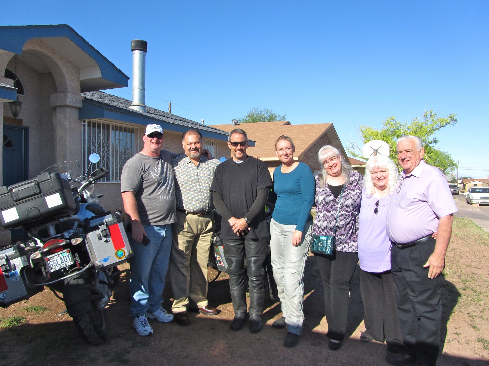
Steve "Sully", Moises, Steve, me, Lynn, Carol and Jim Sullivan. Thanks for letting us stay with you Lynn and Moises.

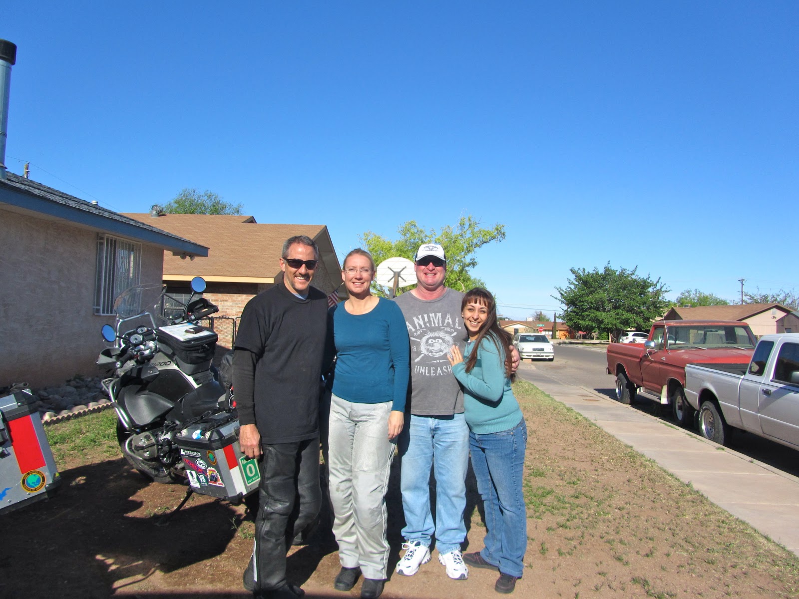
Steve, me, Sully and Glenda.   

Once we had a nice breakfast and coffee in Alamogordo, we stopped by my Mom and Step-Dad's house for a minute. Since they don't live there anymore, I don't feel bad about it only being a minute. I didn't want you to think that we dissed my Mom on this trip. The house has been uninhabited for several years, but hopefully with some updates over the next year, Mom and Bruce will be moving back. This will give me a reason to visit Alamogordo. That's the key word, "visit." I would not want to move back there.

This is the house I spent the last few years of high school in.


We were taking our time getting out of Alamogordo. Knowing that this would likely be the last time I would see Alamo for several years, made me kind of want to take my time heading out. On the way out, we were leaving by way of My Mountains. I took a helmet cam video of the ride up to Cloudcroft, which I'll load at another posting, since it will take some time to edit and then load.

We stopped at the tunnel. This is the same spot from where the first picture in this report was taken. We also went across the street to the place I used to go rappelling every weekend. We even climbed up to the "whole shot" spot. I will try to explain in the captions what that means.

On this cliff, we would tie the ropes off at the very top. There is a cliff in the middle, then a third layer, which you see closest to the bottom, from where the photo is taken. The middle cliff is the "whole shot" spot.
From this perspective, I'm standing at the "whole shot" spot, or the middle cliff. The rope comes from the top of the cliff. The Whole Shot means you jump from where I'm standing and you have to clear the lower cliff without touching it to land at the bottom, which is about 80 ft. The bottom is not visible in this photo.


After my trip down memory lane, we continued up to Cloudcroft. I had to get a photo in front of the Western Bar with the bikes. Another massive memory jolt.


We went inside for a soda. I saw my old friend LeRoy in there and it was great catching up. So, by the time we really hit the road, it was about 2 p.m. with Midland, Texas as the goal.

Once you leave the Sacramento Mountains from the eastern side, there is not a lot to see. Eastern New Mexico and Western Texas is very unattractive. Oil derricks as far as the eye can see and the smell of oil in the air, pretty much all the way to Midland. I got no photos of this trip until we hit the Starbucks on the way out of Midland. (The hotels on I-20 in Midland by the way are outrageously expensive. We got some great advice from a guy in the parking lot of one to go about four miles toward town for a better rate.)


From Midland, we went to the Austin area. Again, nothing much to see from the route we took. Eventually, there were some obviously wealthy farms or ranches, and that made it a nice ride, but not really photo worthy. We stayed the night at my EX-husband, Rob's house. He and his wife Alison were gracious hosts. It's great that I can still be friends with my son's father and his wife (especially since we've all known each other since we were kids). Rob and Ali have a daughter, Asa, who is two. She's a cutie. Reminds me a little of Taylor when he was that age.

Rob, Ali and Asa. Thanks for the hospitality.

Asa is ready for the trip. 
The next stop for us was Natchez, Miss. We didn't really expect any weather, but right about the time we hit the Texas-Louisiana border, we saw some pretty dark clouds ahead.

Looking back at Texas looks nice and clear.
Looking forward to Louisiana not so good.
We stopped to put some rain gear on and ended up with only a few sprinkles. Better safe than sorry. We arrived in Natchez, Miss. before dark and now I'm all caught up on the blog. We will start the Natchez Trace Parkway tomorrow morning with a goal of doing the whole 444 miles to Nashville, Tenn. in one day.

Monday, April 16, 2012

Winds from H. E. double toothpicks

So, we thought the winds in Death Valley were bad. Dear God, the winds in New Mexico are horrible in April. This was one of the things I was concerned about with going to New Mexico in April, and we experienced the worst of it. We left Albuquerque Saturday (April 14) morning. Our first stop was Starbucks, then Sandia BMW Motorcycles. We didn't end up actually leaving Albuquerque until about 11 a.m. or so. We had 250 miles, which means we should have had plenty of time to get to Alamogordo by 6 p.m., the time we had planned to meet some friends for dinner at Margo's.

We decided to go through the east mountains to Carrizozo then through Ruidoso through the Mescalero Indian Reservation, possibly through Cloudcroft to Alamogordo. The first part of the trip through the mountains was great. The wind was not too bad. But then if flattens out onto a plateau and then the wind got crazy. By the time we got to Willard, we needed to take a break. We think winds were gusting at about 60 mph. We found a building we could hide behind from the wind. The pictures do not at all show the horrificness of the wind that day. At one point, I could barely see the lines on the road because of the dust. Here is a picture and a video, but in this, we are protected from the wind.


As we sat there out of the wind, a man named Felix stopped by and offered to let us come hang out at his house. We decided not to, although it was very tempting. He was very nice, but I was determined to keep going. So, we did. It didn't seem as bad as the 10 miles or so prior to Willard, so we continued. What I didn't think about before we left Albuquerque was that we should have just left all of our bags with Sully to bring down to Alamo, since he was coming a couple hours behind us. In Corona, we called Sully and decided to have him meet us in Carrizozo so we could put the bags in his truck.

We kept going to Carrizozo and stopped at the Four Winds restaurant for coffee (appropriate) and waited about 20 minutes for Sully. He also brought a ramp and tie downs in case I wanted to put my bike in the truck, but we decided to just put the bags in and I would try to continue on my bike. Steve was to call him if I just couldn't do it anymore. We had been told by several folks along the way that the wind was even worse in Alamo and the Tularosa Basin.


But we continued on to Alamogordo without the bags. That made a big difference and since it was getting later and later in the afternoon, the wind was slowly dying down. We made it to Margo's by 6:15. We had a few friends waiting for us.


Steve and I on the left, Carol and Jim Sullivan, Moises and Lynn Cardiel, Kathy Flores Hague, Mary and Duane Pirtle. 

Here is a picture of one of the bikes parked at Lynn's house. We stayed there in Alamo Saturday night. But this picture shows the dust covering the windscreen on the bike.


That night we went up to the Western Bar in Cloudcroft, my old stomping grounds from almost 20 years ago. It's always a good time. Sully, Glenda, Steve and I went up to sing some karaoke.


That's all for now. I'll relay our trip out of New Mexico on the next blog. At some point it gets a little boring in western Texas, so I might be able to catch up on the next blog.